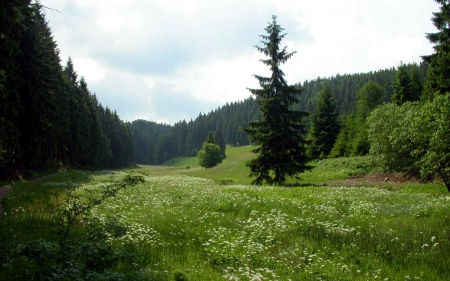
Landscape metrics as a tool for evaluating scenarios for flood prevention and nature conservation
DOI:
https://doi.org/10.3097/LO.201125Keywords:
Biotope types, Comparison of land use scenarios, Conservation assessment, Landscape structure, Mountainous catchmentAbstract
Within the framework of the project "Flood Prevention and Nature Conservation in the Weisseritz area" ("HochNatur"), a method including landscape metrics was developed and applied to assess and to compare different land use scenarios with regard to flood prevention and nature conservation. For the analysis, two sub-catchments strongly differing in land use within the Weisseritz catchment (Eastern Erzgebirge, Saxony, Germany) were selected. The first step of the evaluation procedure was a biotope assessment using three assessment criteria (naturalness, substitutability, rareness/endangerment). However, the biotope assessment did not yield any information about spatial distribution or the structural composition of the landscape. Therefore, landscape metrics were applied to analyse the structural and biotope type diversity at the landscape scale. Different landscape metrics (Shannon/Weaver diversity index, mean patch size index, Interdispersion/Juxtaposition index) and a weighting system were used to compare the different land use scenarios and the current state. The analysed catchment areas differ substantially in terms of their current state and potential measures regarding flood prevention and nature conservation depending on the location and distribution of biotope types. It was demonstrated that this method can be used for small catchment areas regardless of their land use for assessing, analysing and comparing different land use scenarios for a specific area.
References
Auerswald, K. (2002). Landnutzung und hochwasser. Katastrophe Oder Chance? Hochwasser Und Ökologie, 24, 67-76.
Bär, A., & Löffler, J. (2007). Ecological process indicators used for nature protection scenarios in agricultural landscapes of SW norway. Ecological Indicators, 7(2), 396-411. doi:10.1016/j.ecolind.2006.04.001
Bastian, O., & Schreiber, K. -. (1994). Analyse Und Ökologische Bewertung Der Landschaft,
Blaschke, T. (1999). Quantifizierung von fragmentierung, konnektivität und biotopverbund mit GIS. Angewandte Geographische Informationsverarbeitung XI, , 60-73.
Blöchl, G., Ardoin-Bardin, S., Bonell, M., Dorninger, M., Goodrich, D., Gutknecht, D., . . . Szolgay, J. (2007). At what scales do climate variability and land cover change impact on flooding and low flows? Hydrological Processes, 21(9), 1241-1247. doi:10.1002/hyp.6669
Bronstert, A., Fritsch, U., & Katzenmaier, D. (2001). Quantifizierung Des Einflusses Der Landnutzung Und -Bedeckung Auf Den Hochwasserabfluss in Flussgebieten Unter Berücksichtigung Der Aktuellen Bodenbearbeitung, Des Zustandes Der Vegetationsdecke Und Möglicher Klimaänderungen,
Bröring, U., & Wiegleb, G. (1999). Leitbilder in naturschutz und landschaftspflge. Handbunch Naturschutz Und Landschaftspflge, (PART V-1.2), 1-10.
DiBari, J. N. (2007). Evaluation of five landscape-level metrics for measuring the effects of urbanization on landscape structure: The case of tucson, arizona, USA. Landscape and Urban Planning, 79(3-4), 308-313. doi:10.1016/j.landurbplan.2006.04.004
Farina, A. (2000). Landscape ecology in action. Landscape Ecology in Action,
Gergel, S. E. (2005). Spatial and non-spatial factors: When do they affect landscape indicators of watershed loading? Landscape Ecology, 20(2), 177-189. doi:10.1007/s10980-004-2263-y
Herzog, F., Lausch, A., Müller, E., & Thulke, H. -. (1999). Das monitoring von landschaftsveränderungen mit Landschaftsstrukturmaßen - fallstudie espenhain. Erfassung Und Bewertung Der Landschaftsstruktur - Auswertung Mit GIS Und Fernerkundung, 29, 93-106.
Knospe, F. (1998). Handbuch Zur Argumentativen Bewertung.Methodischer Leitfaden Für Planungsbeiträge Zum Naturschutz Und Zur Landschaftsplanung,
Küttner, R. (1999). Rote Liste Biotoptypen.Materialien Zu Naturschutz Und Landschaftspflege,
Lausch, A. (2001). Assessment of landscape pattern and landscape functions by application of GIS and remote sensing
Lausch, A., & Thulke, H. -. (2001). The analysis of spatio-temporal dynamics of landscape structures. Landscape Balance and Landscape Assessment, , 113-136.
Li, X., He, H. S., Bu, R., Wen, Q., Chang, Y., Hu, Y., & Li, Y. (2005). The adequacy of different landscape metrics for various landscape patterns. Pattern Recognition, 38(12), 2626-2638. doi:10.1016/j.patcog.2005.05.009
McGarigal, K., Cushman, S. A., Neel, M. C., & Ene, E. (2002). FRAGSTATS: Spatial pattern analysis program for categorical maps. FRAGSTATS: Spatial Pattern Analysis Program for Categorical Maps,
McGarigal, K., & Marks, B. J. (1995). FRAGSTATS: Spatial pattern analysis program for quantifying landscape structure. FRAGSTATS: Spatial Pattern Analysis Program for Quantifying Landscape Structure,
Merta, M., Seidler, C., Bianchin, S., Heilmeier, H., & Richert, E. (2008). Analysis of land use change in the eastern ore mts. regarding both nature protection and flood prevention. Soil and Water Research, 3, S105-S115. doi:10.17221/1193-swr
Merta, M., Seidler, C., Richert, E., & Bianchin, S. (2007). Analysis of land use change in the eastern erzgebirge regarding both nature protection and flood prevention. Prodeeding of the Conference Bioclimatology and Natural Hazards,
Nagendra, H., Munroe, D. K., & Southworth, J. (2004). From pattern to process: Landscape fragmentation and the analysis of land use/land cover change. Agriculture, Ecosystems and Environment, 101(2-3), 111-115. doi:10.1016/j.agee.2003.09.003
Peng, J., Wang, Y., Zhang, Y., Wu, J., Li, W., & Li, Y. (2010). Evaluating the effectiveness of landscape metrics in quantifying spatial patterns. Ecological Indicators, 10(2), 217-223. doi:10.1016/j.ecolind.2009.04.017
Pöhler, H. (2006). Niederschlagsabflussmodellierung Im Osterzgebirge,
Richert, E., Bianchin, S., Hammer, G., Heilmeier, H., Matschullat, J., Merta, M., & Seidler, C. (2007). Hochwasser- Und Naturschutz Im Weißeritzkreis (HochNa¬tur),
Schindler, S., Poirazidis, K., & Wrbka, T. (2008). Towards a core set of landscape metrics for biodiversity assessments: A case study from dadia national park, greece. Ecological Indicators, 8(5), 502-514. doi:10.1016/j.ecolind.2007.06.001
Schmidt, P. A., Hempel, W., Denner, M., Döring, N., Gnüchtel, A., Walter, B., & Wendel, D. (2002). Potentielle natürliche vegetation sachsens mit karte 1: 200000. Potentielle Natürliche Vegetation Sachsens Mit Karte 1: 200 000,
Usher, M. B., & Erz, W. (1994). Erfassen und bewerten im naturschutz. Erfassen Und Bewerten Im Naturschutz,
Walz, U. (2004). Landschaftsstrukturmaße-indizes, begriffe und methoden. IÖR-Schriften, 43, 15-27.
Walz, U. (2008). Monitoring of landscape change and functions in saxony (eastern germany)-methods and indicators. Ecological Indicators, 8(6), 807-817. doi:10.1016/j.ecolind.2007.09.006
Zhang, L., & Wang, H. (2006). Planning an ecological network of xiamen island (china) using landscape metrics and network analysis. Landscape and Urban Planning, 78(4), 449-456. doi:10.1016/j.landurbplan.2005.12.004

Downloads
Published
How to Cite
Issue
Section
License
Copyright (c) 2019 Sylvi Bianchin, Elke Richert, Hermann Heilmeier, Mariusz Merta, Christina Seidler

This work is licensed under a Creative Commons Attribution 4.0 International License.


