
Temporal fragmentation analysis of a large oak forest in Morocco using landscape metrics
DOI:
https://doi.org/10.3097/LO.2025.1139Keywords:
fragmentation, Landsat imagery, landscape, land-cover change, Maâmora, MoroccoAbstract
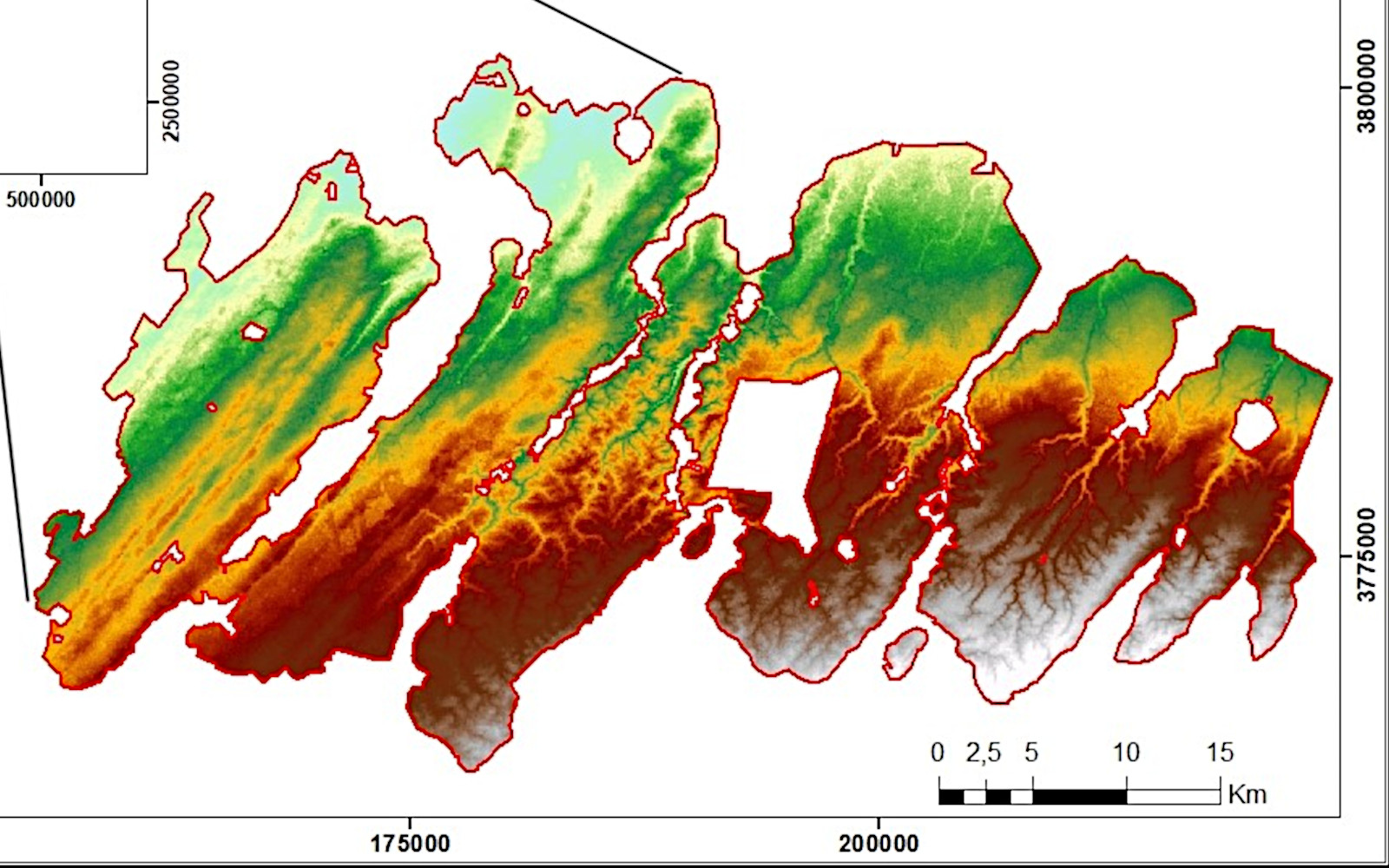
Forest fragmentation, characterized by the reduction of forested areas and changes in their spatial distribution, greatly affects the balance of the physical environment, biodiversity, and species richness. This study aims to assess forest fragmentation and analyze overall landscape heterogeneity using landscape metrics within the Maâmora forest, the largest oak forest in Morocco, covering an area of approximately 133,000 hectares. Landsat imagery spanning a 33-years period (1989-2022) was collected and processed to evaluate forest fragmentation throughout the research period. The results revealed a downward trend in forest land class, whereas bare land, settlements, and paved roads showed an increase in area. From 1989 to 2022, forest land decreased by 15.27% relative to its initial extent in 1989, while bare land, settlements, and paved roads increased by 14.83%, 0.18%, and 0.26%, respectively. The study area was progressively fragmented, as evidenced by increased values of Patch Number (41.29%), Patch Density (41.11%), Edge Density (25.89%), and Interspersion and Juxtaposition Index (17.45%), alongside decreased values of Largest Patch Index (43.24%), Aggregation Index (3.38%) and Effective mesh size (64.67%) at the class level. Moreover, at the landscape level, the Number of Patches, Shannon Diversity Index, and Simpson Diversity Index increased by 33.3%, 15.31%, and 18.03%, respectively, whereas the Contagion Index decreased by 15.65% during the study period. These changes are primarily driven by logging, agricultural expansion, overgrazing, and infrastructure development, which increase habitat fragmentation and reduce ecological connectivity. The findings highlight the adverse effects of land cover change and forest landscape fragmentation, providing spatially explicit information to guide restoration programs and sustainable land-use planning aimed at conserving the Maâmora oak forest.
References
Aafi, A., El Kadmiri, A., A., Benabid, A., Rochdi, M. 2005. Richesse et diversité floristique de la suberaie de la Mamora (Maroc) [Richness and floristic diversity of the cork oak forest of Mamora (Morocco)]. Acta Botanica Malacitana, 30, 127– 138. https://doi.org/10.24310/abm.v30i0.7187.
Aafi, A. 2007. Etude de la diversité floristique de l’écosystème de chêne-liège de la forêt de la Maamora, [Study of Plant Diversity of Cork Oak Ecosystem in the Maamora Forest.]. Thèse de doctorat d’Etat Es-Science Agronomique, Institut agronomique et vétérinaire Hassan II, Rabat, 190p.
Abdullah, S.A., Nakagoshi, N. 2007. Forest fragmentation and its correlation to human land use change in the state of Selangor, peninsular Malaysia. For. Ecol. Manage. 241, 39– 48. https://doi.org/10.1016/j.foreco.2006.12.016. Adepoju, K. A., Salami, A. T. 2017. Geospatial Assessment of Forest Fragmentation and its Implications for Ecological rocesses in Tropical Forests. Journal of Landscape Ecology, 10(2), 19–34. https://doi.org/10.1515/jlecol-2017-0002.
Akçakaya, H. R., Cantara, K., Vaillant, H., Diamond, D., True, D., Rewerts, C. C., and Lozar, R. 2006. Evaluation of Models to Support Habitat Fragmentation Analysis; Report; U.S. Army Corps of Engineers, Engineer Research and Development Center: Washington, DC, USA, 2006; 133p.
Bagaram, B.M. 2014. Elaboration d’une base de données géographique et catalogue des stations de la subéraie de la Maâmora, Mémoire de troisième cycle, ENFI, Salé, 79P.
Benabid, A. 2000. Flore et écosystème du Maroc: évaluation et préservation de la biodiversité. Ibis Press, Paris, p. 357.
Benabou, A., Moukrim, S., Lahssini, S., El Aboudi, A., Menzou, K., Elmalki, M., El Madihi, M., Rhazi, L. 2022a. Impact of the climate change on potential distribution of Quercus suber in the conditions of North Africa. Biosystems Diversity, 30(3), 289–294. https://doi.org/10.15421/012231.
Benabou, A., Moukrim, S., Laaribya, S., Aafi, A., Chkhichekh, A., El Maadidi, A., EL Aboudi, A. 2022b. Mapping Ecosystem Services of Forest Stands: Case Study of Maamora, Morocco. Vol.15, № 1. Geography, Environment, Sustainability, p 141- 149. https://doi.org/10.24057/2071-9388-2021-047.
Boubekraoui, H., Maouni, Y., Ghallab, A., Draoui, M., Maouni, A. 2023. Spatio-temporal analysis and identification of
deforestation hotspots in the Moroccan western Rif. Trees, Forests and People, 12. https://doi.org/10.1016/j.tfp.2023.100388.
Bracchetti, L., Carotenuto, L., Catorci, A. 2012. Land-cover changes in a remote area of central Apennines (Italy) and management directions. Landscape and Urban Planning, 104, 157e170. https://doi.org/10.1016/j.landurbplan.2011.09.005.
Çakir, G., Sivrikaya, F., Keleş, S. 2007. Forest cover change and fragmentation using Landsat data in Maçka State Forest Enterprise in Turkey. Environmental Monitoring and Assessment, 137(1-3), 51–66. https://doi.org/10.1007/s10661-007-9728-9.
Carranza, M. L., Acosta, A., Ricotta, C. 2007. Analyzing landscape diversity in time: The use of Rènyi’s generalized entropy function. Ecological Indicators, 7(3), 505–510. https://doi.org/10.1016/j.ecolind.2006.05.005.
Carranza, M., Hoyos, L., Frate, L., Acosta, A., Cabido, M. 2015. Measuring forest fragmentation using multitemporal forest cover maps: Forest loss and spatial pattern analysis in the Gran Chaco, central Argentina. Landscape and Urban Planning, 143: 238-247. https://doi.org/10.1016/j.landurbplan.2015.08.006.
Cheruto, M. C., Kauti, M. K., Kisangau, D. P., Kariuki, P. C. 2016. Assessment of land use and land cover change using GIS and remote sensing techniques: a case study of Makueni County, Kenya. Journal of Remote Sensing & GIS, 05(04): 175. https://doi.org/10.4175/2469-4134.1000175.
Cherki, K. 2013. Analysis of the spatial distribution of forest fires as a function of anthropic, ecological and biophysical factors. The case of the Mâamora forest (northern Morocco). Open Edition Journals. https://doi.org/10.4000/etudescaribeennes.10978.
Cohen, M., Varga, D., Vila, J., Barrassaud, E. 2010. A multi- scale and multi-disciplinary approach to monitor landscape dynamics: a case study in the Catalan pre-Pyrenees (Spain). The Geographical Journal, 177(1), 79–91. https://doi.org/10.1111/j.1475-4959.2010.00368.x
Coppin, P., Jonckheere, I., Nackaerts, K., Muys, B., Lambin, E. 2004. Review Article Digital change detection methods in ecosystem monitoring: a review. Int. J. Remote Sens. 25, 1565–1596. https://doi.org/10.1080/0143116031000101675.
Da Ponte, E., Roch, M., Leinenkugel, P., Dech, S., Kuenzer, C. 2017. Paraguay’s Atlantic Forest cover loss – Satellite-based change detection and fragmentation analysis between 2003 and 2013. Applied Geography, 79, 37–49. https://dx.doi.org/10.1016/j.apgeog.2016.12.005.
Daye, D. D., Healey, J. R. 2015. Impacts of land-use change on sacred forests at the landscape scale. Global Ecology and Conservation, 3, 349–358. https://doi.org/10.1016/j.gecco.2014.12.009.
Dessie, G., Kleman, J. 2007. Pattern and Magnitude of Deforestation in the South Central Rift Valley Region of Ethiopia. Mountain Research and Development, 27(2), 162–168. https://dx.doi.org/10.1659/mrd.0730.
Dutta, S., Dutta, I., Das, A., Guchhait, S. K. 2020. Quantification and Mapping of fragmented forest landscape in Dry Deciduous Forest of Burdwan Forest Division, West Bengal, India. Trees, Forests and People, 100012. https://doi.org/10.1016/j.tfp.2020.100012.
Echeverria, C., Coomes, D. A., Hall, M., Newton, A. C. 2008. Spatially explicit models to analyze forest loss and fragmentation between 1976 and 2020 in southern Chile. Ecological Modelling, 212(3-4), 439–449. https://doi.org/10.1016/j.ecolmodel.2007.10.045.
Fahrig, L. 2003. Effects of habitat fragmentation on biodiversity. Annu. Rev. Ecol. Evol. Syst. 34, 487–515. https://doi.org/10.1146/annurev.ecolsys.34.011802.132419.
FAO, 2015. Plan Bleu pour l’Environnement et le Développement en méditerranée, Optimiser la production des biens et services par les écosystèmes boisés méditerranéens dans un contexte de changements globaux ; Rapport technique : Analyse de vulnérabilité au changement climatique du couvert forestier Forêt de la Maâmora (Maroc) 124p.
Fennane, M., Rejdali, M. 2015. The World Largest Cork Oak Maamora Forest: Challenges and the Way Ahead. Flora Mediterranea, 25, 277-285. http://www.herbmedit.org/flora/FL25SI_277-286.pdf.
Fischer, J., Lindenmayer, D. B. 2007. Landscape modification and habitat fragmentation: a synthesis. Global Ecology and Biogeography, 16(3), 265–280. https://doi.org/10.1111/j.1466-8238.2007.00287.x.
Flowers, B., Huang, K.-T., Aldana, G. O. 2020. Analysis of the Habitat Fragmentation of Ecosystems in Belize Using Landscape Metrics. Sustainability, 12(7), 3024. https://doi.org/10.3390/su12073024.
Gebremicael, T. G., Mohamed, Y. A., van der Zaag, P., Hagos, E. Y. 2018. Quantifying longitudinal land use change from land degradation to rehabilitation in the headwaters of Tekeze-Atbara Basin, Ethiopia. Science of The Total Environment, 622, 1581–1589. https://doi.org/10.1016/j.scitotenv.2017.10.034.
Geri, F., Rocchini, D., Chiarucci, A. 2010. Landscape metrics and topographical determinants of large-scale forest dynamics in a Mediterranean landscape. Landscape and Urban Planning, 95(1-2), 46–53. https://doi.org/10.1016/j.landurbplan.2009.12.001.
Ghouldan, A., Benhoussa, A., Ichen, A. 2024. Evolution of Land Use/Land Cover in Mediterranean Forest Areas – ACase Study of the Maamora in the North-West Morocco. Ecological Engineering & Environmental Technology, 25(10), 134-149. https://doi.org/10.12912/27197050/191413.
Haddad, N. M., Brudvig, L. A., Clobert, J., Davies, K. F., Gonzalez, A., Holt, R. D., Townshend, J. R. 2015. Habitat fragmentation and its lasting impact on Earth’s ecosystems. Science Advances, 1(2), e1500052–e1500052. https://doi.org/10.1126/sciadv.1500052.
Heilman, G. E., Strittholt, J. R., Slosser, N. C., Dellasala, D. A. 2002. Forest Fragmentation of the Conterminous United States: Assessing Forest Intactness through Road Density and Spatial Characteristics: Forest fragmentation can be measured and monitored in a powerful new way by combining remote sensing, geographic information systems, and analytical software. BioScience, 52(5), 411– 422. https://doi.org/10.1641/0006-3568(2002)052[0411:ff otcu]2.0.co;2.
Hermosilla, T., Wulder, M. A., White, J. C., Coops, N. C., Pickell, P. D., Bolton, D. K. 2019. Impact of time on interpretations of forest fragmentation: Three-decades of fragmentation dynamics over Canada. Remote Sensing of Environment, 222, 65–77. https://doi.org/10.1016/j.rse.2018.12.027.
Ibanez, I., Katz, D. S. W., Peltier, D., Wolf, S. M., Connor Barrie, B. T. 2014. Assessing the integrated effects of landscape fragmentation on plants and plant communities: the challenge of multiprocess-multiresponse dynamics. Journal of Ecology, 102(4), 882–895. https://doi.org/10.1111/1365-2745.12223.
Jaeger, J.A.G. 2000. Landscape division, splitting index, and effective mesh size: New measures of landscape fragmentation. Landscape Ecology 15(2), 115–130. https:// doi.org/10.1023/A:1008129329289.
Jaeger, J.A.G., Schwarz-von Raumer, H.G., Esswein, H., Müller, M., Schmidt-Lüttmann, M. 2007. Time series of landscape fragmentation caused by transportation infrastructure and urban development: a case study from Baden-Württemberg (Germany). Ecology and Society 12(1): 22. http://www.ecologyandsociety.org/vol12/iss1/art22/.
Jensen, J. R. 2005. Introductory digital image processing: a remote sensing perspective. Pearson Prentice Hall, Upper Saddle River, 505-512.
Karimi, J. D., Corstanje, R., Harris, J. A. 2021. Understanding the importance of landscape configuration on ecosystem service bundles at a high resolution in urban landscapes in the UK. Landscape Ecology, 36(7), 2007–2024. https://doi.org/10.1007/s10980-021-01200-2.
Kumar, M., Denis, D. M., Singh, S. K., Szabó, S., Suryavanshi, S. 2018. Landscape metrics for assessment of land cover change and fragmentation of a heterogeneous watershed. Remote Sens Appl Soc Environ 10: 224–233. https://doi.org/10.1016/j.rsase.2018.04.002.
Kupfer, J. A., Malanson, G. Franklin, S. B. 2006. Not seeing the ocean for the islands: the mediating influence of matrix-based processes on forest fragmentation effects. Global Ecology and Biogeography 15, 8–20. https://doi.org/10.1111/j.1466-822x.2006.00204.x.
Laaribya, S. 2006. Il faut sauver la forêt de la Maamora (Maroc), Revue de la forêt méditerranéenne TXXVII N°1, Mars 2006 nP. 65- 72.
Laaribya, S., Gmira, N., Alaoui, A. 2010. Towards a coordinated development of the forest in Maamora (Morocco). Journal of Forestry Faculty, 10 (2): 172-179. http://www.kastamonu.edu.tr/Akademik/Orman/Dergi_O,Orman_Dergi_Dergimiz. html.
Lahssini, S., Lahlaoi, H., Mharzi Alaoui, H., Hlal, E.A., Bagaram, M. Ponette, Q. 2015. Predicting Cork Oak Suitability in Maâmora Forest Using Random Forest Algorithm. Journal of Geographic Information System, 7, 202- 210. http://dx.doi.org/10.4236/jgis.2015.72017.
Lausch, A., Herzog, F. 2002. Applicability of landscape metrics for the monitoring of landscape change: issues of scale, resolution and interpretability. Ecological Indicators, 2(1-2), 3–15. https://doi.org/10.1016/s1470-160x(02)00053-5.
Laurance, W. F. 1994. Rain-Forest fragmentation and the structure of small mammal communities in tropical Queensland. Biological Conservation 69: 23–32. https:// doi.org/10.1016/0006-3207(94)90325-5.
Laurance, W. F., Pérez-Salicrup, D., Delamônica, P., Fearnside, P. M., D’Angelo, S., Jerozolinski, A., Lovejoy, T. E. 2001. Rain forest fragmentation and the structure of Amazonian liana communities. Ecology 82, 105–116. https://doi.org/10.1890/0012-9658(2001)082[0105:RFFATS]2.0.CO;2.
Laurance, W. F., Nascimento, H. E., Laurance, S. G., Andrade, A., Ewers, R. M., Harms, K. E., Luizao, R. C., Ribeiro, J. E. 2007. Habitat fragmentation, variable edge efects, and the landscape-divergence hypothesis. PLoS One 2:1–8. https://doi.org/10.1371/journal.pone.0001017.
Lele, N., Joshi, P. K., Agrawal, S. P. 2008. Assessing forest fragmentation in northeastern region (NER) of India using landscape matrices. Ecological Indicators, 8(5), 657– 663. https://doi.org/10.1016/j.ecolind.2007.10.002.
Li, X., He, H. S., Bu, R., Wen, Q., Chang, Y., Hu, Y., $Li, Y. 2005. The adequacy of different landscape metrics for various landscape patterns. Pattern Recognition, 38(12), 2626–2638. https://doi.org/10.1016/j.patcog.2005.05.009.
Li, M., Huang, C., Zhu, Z., Shi, H., Lu, H., Peng, S. 2009. Assessing rates of forest change and fragmentation in Alabama, USA, using the vegetation change tracker model. Forest Ecology and Management, 257(6), 1480–1488. https://doi.org/10.1016/j.foreco.2008.12.023.
Lilles-sand, T.M., Kiefer, R.W. 2007. Remote sensing and image interpretation. JohnWiley and Sons, New York.
Liu, Y. L., Feng, Y. H., Zhao, Z., Zhang, Q. W., Su, S. L. 2016. Socioeconomic drivers of forest loss and fragmentation: A comparison between different land use planning schemes and policy implications. Land Use Policy, 54: 58-68. https://doi.org/10.1016/j.landusepol.2016.01.016.
Malki, F., Al Karkouri, J., Sabir, M., El Mderssa, M., Dallahi, Y. 2022. Contribution of geomatics tools to the study of the spatio- temporal evolution of forest stands of the Maamora forest in the face of global changes. E3S Web of Conferences 337, 01001. https://doi.org/10.1051/e3sconf/202233701001.
Martinez del Castillo, E., García-Martin, A., Longares Aladrén, L. A., de Luis, M. 2015. Evaluation of forest cover change using remote sensing techniques and landscape metrics in Moncayo Natural Park (Spain). Applied Geography, 62, 247– 255. http://dx.doi.org/10.1016/j.apgeog.2015.05.002.
McGarigal, K., Marks, B. J. 1995. FRAGSTATS: Spatial pattern analysis program for quantifying landscape structure. Corvallis: Forest Science Department, Oregon State University.
McGarigal, K., Cushman, S. A., Neel, M. C., Ene, E. 2002. FRAGSTATS v3: Spatial pattern analysis program for categorical maps. Computer software program produced by the authors at the University of Massachusetts, Amherst. Available at the following web site http://www.umass.edu/landeco/research/fragstats/ fragstats.html.
McGarigal, K., Cushman, S. A., Ene, E. 2012. FRAGSTATS v4: Spatial Pattern Analysis Program for Categorical and Continuous Maps. Computer software program produced by the authors at the University of Massachusetts, Amherst, Available at the following web site http://www.umass.edu/landeco/research/fragstats/fragstats.html.
McGarigal, K. 2013. Landscape Pattern MetricsBased in part on the article “Landscape pattern metrics” by Kevin McGarigal, which appeared in the Encyclopedia of Environmetrics. Encyclopedia of Environmetrics. https://doi.org/10.1002/9780470057339.val006.pub2.
Mediani, M., Brito, J.C., Fahd, S. 2015. Atlas of the amphibians and reptiles of northern Morocco: updated distribution and patterns of habitat selection. Basic Appl. Herpetol. https://doi.org/10.11160/bah.14009.
Mehta, A., Shukla, S., Rakholia, S. 2022. Assessment of forest fragmentation in greater Gir landscape area, Gujarat using geospatial techniques. Journal of Geomatics, 16(2), 146– 152. https://doi.org/10.58825/jog.2022.16.2.43.
Mengist, W., Teshome Soromessa, T., Feyisa, G. L. 2022. Forest fragmentation in a forest Biosphere Reserve: Implications for the sustainability of natural habitats and forest management policy in Ethiopia. Resources, Environment and Sustainability, Vol 8. https://doi.org/10.1016/j.resenv.2022.100058.
Mottet, A., Ladet, S., Coqué, N., Gibon, A. 2006. Agricultural land-use change and its drivers in mountain landscapes: A case study in the Pyrenees. Agriculture, Ecosystems & Environment, 114(2-4), 296–310. https://doi.org/10.1016/j. agee.2005.11.017.
Moukrim, S., Benabou, A., Lahssini, S., Aafi, A., Chkhichekh, A., Moudden, F., Ben Bammou, M., El Aboudi, A., Laaribya, S. 2022. Spatio-temporal analysis of North African forest cover dynamics using time series of vegetation indices – case of the Maamora forest (Morocco). Biosystems Diversity, 30(4), 372–379. https://doi.org/10.15421/012236.
Mounir, F. 2002. Conception d’un système d’information géographique pour l’aménagement et la gestion forestière au Maroc ; Intégration des critères et indicateurs du développement durable ; Application à la forêt de la Maamora. [Conception d’un Système d’Information Géographique pour la Planification et la Gestion Forestière au Maroc ; Intégration des Critères et Indicateurs de Développement Durable ; Application à Maamora Forest.] Thèse de Doctorat, UCL, Belgique.
Mugiraneza, T., Haas, J., Ban, Y. 2017. Spatiotemporal analysis of urban land cover changes in Kigali, Rwanda using multitemporal landsat data and landscape metrics. Int. Arch. Photogramm. Remote Sens. Spatial Inf. Sci., XLII-3/W2,137– 144, Tshwane, South Africa. https://doi.org/10.5194/isprs-archives-XLII-3-W2-137-2017.
Muhammed, A., Elias, E. 2021. Class and landscape level habitat fragmentation analysis in the Bale mountains national park, southeastern Ethiopia. Heliyon, 7(7), e07642. https://doi.org/10.1016/j.heliyon.2021.e07642.
Mulatu, K., Hundera, K., Senbeta, F. 2024. Analysis of land use/ land cover changes and landscape fragmentation in the Baro-Akobo Basin, Southwestern Ethiopia. Heliyon, 10. https://doi.org/10.1016/j.heliyon.2024.e28378.
Myers, N., Mittermeier, R. A., Mittermeier, C. G., Fonseca, G. A. B., Kent, J. 2000. Biodiversity Hotspots For Conservation Priorities. Nature, 403, 853–858. https://doi.org/10.1038/35002501.
Narmada, K., Gogoi, D., Dhanusree Bhaskaran, G. 2021. Landscape metrics to analyze the forest fragmentation of Chitteri Hills in Eastern Ghats, Tamil Nadu. J Civil Eng Environ Sci 7(1): 001-007. https://dx.doi.org/10.17352/2455-488X.000038.
Natividade, J. 1956. Subériculture, Edition Française de l’ouvrage portugais.
Netzel, P., Tyminska, L., Feleha, D. D., Socha, J. 2024. New approach to assess forest fragmentation based on multiscale similarity index. Ecological Indicators, 158. https://doi.org/10.1016/j.ecolind.2023.111530.
Newman, M. E., McLaren, K. P., Wilson, B. S. 2014. Assessing deforestation and fragmentation in a tropical moist forest over 68 years; the impact of roads and legal protection in the Cockpit Country, Jamaica. Forest Ecology and Management, 315, 138–152. https://doi.org/10.1016/j.foreco.2013.12.033.
Noumonvi K. D., Mounir F., Belghazi B. 2017. Spatial Multi- Criteria Based Analysis to Assess Dynamics and Vulnerability of Forest Ecosystems to Global Changes: Case of Maamora Forest-Morocco. Open Access Library Journal, 4: e3889. https://doi.org/10.4236/oalib.1103889.
Oertli, B., Joye, D. A., Castella, E., Juge, R., Cambin, D., Lachavanne, J.-B. 2002. Does size matter? The relationship between pond area and biodiversity. Biological Conservation, 104(1), 59–70. https://doi.org/10.1016/S0006-3207(01)00154-9.
Olson, D., DellaSala, D. A., Noss, R. F., Strittholt, J. R., Kass, J., Koopman, M. E., Allnutt, T. F. 2012. Climate Change Refugia for Biodiversity in the Klamath-Siskiyou Ecoregion. Natural Areas Journal, 32(1), 65–74. https://doi.org/10.3375/043.032.0108.
Ostrom, E., Nagendra, H. 2006. Insights on linking forests, trees, and people from the air, on the ground, and in the laboratory. Proceedings of the National Academy of Sciences, 103(51), 19224–19231. https://doi.org/10.1073/pnas.0607962103.
Oubrahim, H. 2015. Estimation et cartographie du stock de carbone dans l’écosystème de quercus suber de la Mamora occidentale (cantons A et B) et estimation de son stock d’éléments nutritifs, Thèse de doctorat, Université Mohammed V Faculté des sciences Rabat 202p.
Plexida, S. G., Sfougaris, A. I., Ispikoudis, I. P., Papanastasis, V. P. 2014. Selecting landscape metrics as indicators of spatial heterogeneity—A comparison among Greek landscapes. International Journal of Applied Earth Observation and Geoinformation, 26, 26–35. http://dx.doi.org/10.1016/j.jag.2013.05.001.
Pôças, I., Cunha, M., Pereira, L. S. 2011. Remote sensing based indicators of changes in a mountain rural landscape of Northeast Portugal. Applied Geography, 31(3), 871–880. https://doi.org/10.1016/j.apgeog.2011.01.014.
Pyngrope, O. R., Kumar, M., Pebam, R., Singh, S. K., Kundu, A., Lal, D. 2021. Investigating forest fragmentation through earth observation datasets and metric analysis in the tropical rainforest area. SN Applied Sciences, 3(7). https://doi.org/10.1007/s42452-021-04683-5.
Ripperger, S. P., Tschapka, M., Kalko, E. K. V., Rodriguez-Herrera, B., Mayer, F. 2012. Life in a mosaic landscape: anthropogenic habitat fragmentation affects genetic population structure in a frugivorous bat species. Conservation Genetics, 14(5), 925–934. https://doi.org/10.1007/s10592-012-0434-y.
Rodríguez, Y. A., Pérez, Y. A., Roa, L. V., Rodríguez, C. J., Rodríguez, H. D. G., Villa, M. D. 2020. Spatio-Temporal Analysis of Forest Fragmentation in Río Botello Catchment at Facatativá (Colombia). International Journal of Sustainable Development and Planning, Vol. 15, pp. 1169-1178. https://doi.org/10.18280/ijsdp.150803.
Serra, P., Pons, X., Saurí, D. 2008. Land-cover and land-use change in a Mediterranean landscape: A spatial analysis of driving forces integrating biophysical and human factors. Applied Geography, 28(3), 189–209. https://doi.org/10.1016/j.apgeog.2008.02.001.
Sharma, M., Chakraborty, A., Garg, J.K., Joshi, P.K. 2017. Assessing forest fragmentation in north-western Himalaya: A case study from Ranikhet forest range, Uttarakhand, India. Journal of Forestry Research, 28(2): 319-327. https://doi.org/10.1007/s11676-016-0311-5.
Singh, S. K., Pandey, A. C., Singh, D. 2014. Land Use Fragmentation Analysis Using Remote Sensing and Fragstats BT - Remote Sensing Applications in Environmental Research (P. K. Srivastava, S. Mukherjee, M. Gupta, & T. Islam (eds.); pp. 151–176). Cham: Springer International Publishing. https://doi.org/10.1007/978-3-319-05906-8_9.
Skole, D., Tucker, C. 1993. Tropical deforestation and habitat fragmentation in the Amazon: satellite data from 1978 to 1988. Science 260 (5116), 1905–1910. https://doi. org/10.1126/science.260.5116.1905.
Southworth, J., Nagendra, H., Munroe, D. K. 2006. Introduction to the special issue: Are parks working? Exploring human– environment tradeoffs in protected area conservation. Applied Geography, 26(2), 87–95. https://doi.org/10.1016/j.apgeog.2005.11.001.
Soverel, N. O., Coops, N. C., White, J. C., Wulder, M. A. 2009. Characterizing the forest fragmentation of Canada’s national parks. Environmental Monitoring and Assessment, 164(1-4), 481–499. https://doi.org/10.1007/s10661-009-0908-7.
Tang, J., Bu, K., Yang, J., Zhang, S., Chang, L. 2012. Multitemporal analysis of forest fragmentation in the upstream region of the Nenjiang River Basin, Northeast China. Ecological Indicators, 23, 597–607. https://doi.org/10.1016/j.ecolind.2012.05.012.
Tolessa, T., Senbeta, F., Kidane, M. 2016. Landscape composition and configuration in the central highlands of Ethiopia. Ecology and Evolution, 6(20), 7409–7421. https:// doi.org/10.1002/ece3.2477.
USGS, 2013. Landsat Processing Details [WWW Document]. http://www.usgs.gov/in.
Vogt, P., Riitters, K. H., Estreguil, C., Kozak, J., Wade, T. G., Wickham, J. D. 2007. Mapping spatial patterns with morphological image processing. Landsc Ecol 22, 171–177. https://doi.org/10.1007/s10980-006-9013-2.
Vogt, P., Riitters, K. 2017. Guidos Toolbox: universal digital image object analysis. Europ. J. Rem. Sensing 50, 352–361. https://doi.org/10.1080/ 22797254.2017.1330650.
Zahra, L., Thami, D. 2024. Impact of urban dynamics and climate change on forest areas the Maamora forest in the city of Kenitra, Morocco. Multidisciplinary Science Journal, 6(7), 2024123. https://doi.org/10.31893/multiscience.2024123.
Zambrano, J., Garzon-Lopez, C. X., Yeager, L., Fortunel, C., Cordeiro, N. J., Beckman, N. G. 2019. The effects of habitat loss and fragmentation on plant functional traits and functional diversity: what do we know so far? Oecologia. https://doi.org/10.1007/s00442-019-04505-x.
Zhang, L., Liu, Y., Wei, X. 2017. Forest Fragmentation and Driving Forces in Yingkou, Northeastern China. Sustainability, 9(3), 374. https://doi.org/10.3390/su9030374.
Zhang, Y., Shen, W., Li, M., Lv, Y. 2020. Assessing spatio- temporal changes in forest cover and fragmentation under urban expansion in Nanjing, eastern China, from long-term Landsat observations (1987–2017). Applied Geography, 102190. https://doi.org/10.1016/j.apgeog.2020.102190.
Zomeni, M., Tzanopoulos, J., Pantis, J. D. 2008. Historical analysis of landscape change using remote sensing techniques: An explanatory tool for agricultural transformation in Greek rural areas. Landscape and Urban Planning, 86(1), 38–46. https://doi.org/10.1016/j.landurbplan.2007.12.006.
Downloads
Published
How to Cite
Issue
Section
License
Copyright (c) 2025 Abderrahym Ghouldan, Abdelaziz Benhoussa, Abdellah Ichen

This work is licensed under a Creative Commons Attribution 4.0 International License.