
Online Public Participation Geographic Information System (PPGIS) as a landscape and public use management tool: a case study from the Ebro Delta Natural Park (Spain)
DOI:
https://doi.org/10.3097/LO.202193Keywords:
Public Participation Geographic Information Systems, Google Maps, Park Experience, Decision Support, Landscape Values MappingAbstract
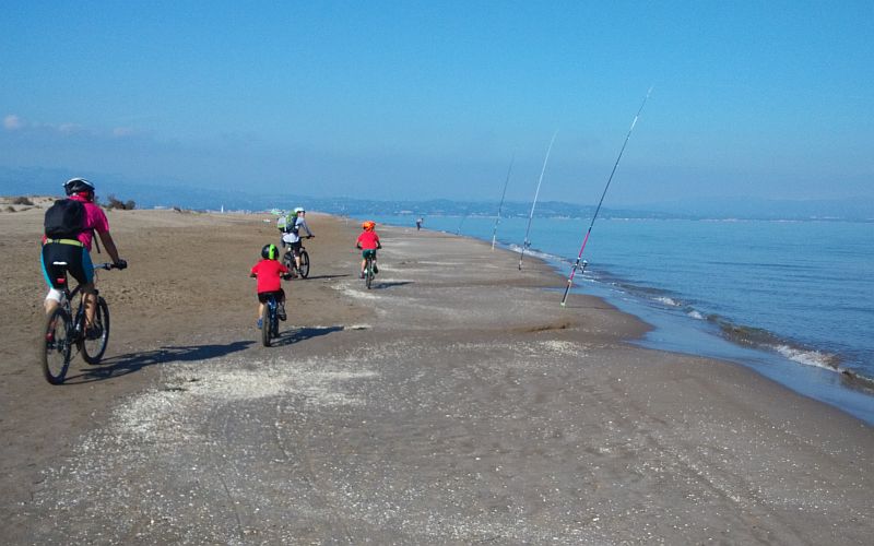
This paper presents a Public Participation Geographic Information System (PPGIS) application conducted in the Ebro Delta Natural Park, Spain. It aims to support decision-making and management activities. The application is based on an online PPGIS questionnaire using Google Maps API. Participants were asked about the spatial and temporal usage while visiting the Natural Park, about their landscape preferences, and appreciations. A set of eight pairs of bipolar adjectives related to landscape characteristics and experience, four items related to public use, and nine to leisure activities were used. In total, 204 valid answers and 3,969 georeferenced opinions were mapped by this case study. The results of this mapping give insights in the use, perception and appreciation of landscape naturalness and aesthetic beauty, accessibility, facilities, services, and signposting. Furthermore, this study discuss the outcomes of mapping the results and how they support the park management with regard to the identification of conflicts, and the need for action. Finally, this study discuss potentials and limitations of PPGIS as a tool for public participation to capture visitors' experiential knowledge in order to optimize and enhance the management of protected areas.
References
Anton-Clavé, S., Nel-lo, M. G., & Orellana, A. 2007. Coastal Tourism in Natural Parks. An Analysis of Demand Profiles and Recreational Uses in Coastal Protected Natural Areas. Turismo & Desenvolvemento, 7/8, 69-81. DOI:10.34624/rtd.v0i7/8.13729
Antrop, M., 2000. Background concepts for integrated landscape analysis. Agriculture, Ecosystems and Environment 77, 17–28. DOI:10.1016/S0167-8809(99)00089-4 DOI: https://doi.org/10.1016/S0167-8809(99)00089-4
Bearman, N., Appleton, K. 2012. Using Google Maps to collect spatial responses in a survey environment. Area44,2, 160-169. DOI:10.1111/j.1475-4762.2012.01081.x DOI: https://doi.org/10.1111/j.1475-4762.2012.01081.x
Bell S., Tyrväinen, L., Sievänen, T., Pröbstl, U., Simpson, M. 2007. Outdoor Recreation and Nature Tourism: A European Perspective. DOI:10.12942/lrlr-2007-2 DOI: https://doi.org/10.12942/lrlr-2007-2
Blicharska, M., Orlikowska, E.H., Roberge, J-M., Grodzinska-Jurczak, M. 2016. Contribution of social science to large scale biodiversity conservation: A review of research about the Natura 2000 network. Biologica lConservation 199, 110-122. DOI:10.1016/j.biocon.2016.05.007 DOI: https://doi.org/10.1016/j.biocon.2016.05.007
Brown, G., Kyttä, M. 2014. Key issues and research priorities for public participation GIS (PPGIS): A synthesis based on empirical research. Applied Geography 46, 122-136. DOI:10.1016/j.apgeog.2013.11.004 DOI: https://doi.org/10.1016/j.apgeog.2013.11.004
Brown, G., Weber, D. 2011. Public Participation GIS: A new method for national park planning. Landscape and Urban Planning 102, 1-15. DOI:10.1016/j.landurbplan.2011.03.003 DOI: https://doi.org/10.1016/j.landurbplan.2011.03.003
Carrus, G., Scopelliti, M., Lafortezza, R., Colangelo, G., Ferrini, F., Salbitano, F., Agrimi, M., Portoghesi, L., Semenzato, P., Sanesi, G. 2015. Go greener, feel better?. The positive effects of biodiversity on well-being of individuals visiting urban and periurban green areas. Landscape and Urban Planning 134, 221-228. DOI:10.1016/j.landurbplan.2014.10.022 DOI: https://doi.org/10.1016/j.landurbplan.2014.10.022
Carver, S., Evans, A., Kingston, R., Turton, I. 2001. Public participation, GIS, and cyberdemocracy: evaluating on-line spatial decision support systems. Environmment and Planning B: Planning and Design, 28, 907-921. DOI:10.1068/b2751t DOI: https://doi.org/10.1068/b2751t
Chien, C.Y-M., Carver, S., Comber, A. 2021. An Exploratory analysis of expert and Nonexpert-Based Land-scape Aesthetics evaluations: A case study from Wales. Land 10, 1-17. DOI:10.3390/land10020192 DOI: https://doi.org/10.3390/land10020192
Corbett, J., Cochrane, L., Gill, M. 2016. Powering Up: Revisiting Participatory GIS and Empowerment. The Cartographic Journal 53, 4, 335-340. DOI:10.1080/00087041.2016.1209624 DOI: https://doi.org/10.1080/00087041.2016.1209624
Czepkiewicz, M., Jankowski, P., Młodkowski, M. 2016. Geo-questionnaires in urban planning: recruitment methods, participant engagement, and data quality. Cartography and Geographic Information Science 44, 551-567. DOI:10.1080/15230406.2016.1230520 DOI: https://doi.org/10.1080/15230406.2016.1230520
Eagles, P.F.J., McCool, S.F., Haynes, C. 2002. Sustainable Tourism in Protected Areas: Guidelines for Planning and Management. IUCN, Gland. DOI: https://doi.org/10.1079/9780851995892.0000
Engen, S., Runge, C., Brown, G., Fauchald, P., Nilsen, L., Hausner, V. 2018. Assessing local acceptance of protected area management using public participation GIS (PPGIS). Journal of Nature Conservancy 43, 27–34. DOI:10.1016/j.jnc.2017.12.002 DOI: https://doi.org/10.1016/j.jnc.2017.12.002
ESRI 2021. ESRI GIS Dictionary. https://support.esri.com/en/other-resources/gis-dictionary/browse/ [Accessed 17 March 2021].
EUROPARC 2005. Manual Sobre Conceptos de uso Público en los Espacios Naturales Protegidos. Fundación González Bernáldez, Madrid.
Farías Torbidoni, E. I. 2011. Managing for Recreational Experience Opportunities: The Case of Hikers in Protected Areas in Catalonia, Spain. Environmental Management 47, 482-496. DOI:10.1007/s00267-010-9606-z DOI: https://doi.org/10.1007/s00267-010-9606-z
Farías-Torbidoni, E.I., Mas-Alòs, S., Gil-Moreno de Mora, G., Lavega-Burgués, P., Castañer, M., Lorente-Catalán E., Seguí-Urbaneja, J., Lacasa-Claver, E. 2010. Health and Well-Being in Protected Natural Areas—Visitors’ Satisfaction in Three Different Protected Natural Area Categories in Catalonia, Spain. International Journal of Environmental Research and Public Health 17, 1-19. DOI:10.3390/ijerph17186746 DOI: https://doi.org/10.3390/ijerph17186746
Generalitat de Catalunya 2010. Terres de l’Ebre. Catàleg de paisatge. http://www.catpaisatge.net/eng/catalegs_presentats_E.php [Accessed 17 March 2021].
Generalitat de Catalunya 2021. Parc Natural del Delta de l’Ebre. http://parcsnaturals.gencat.cat/ca/delta-ebre [Accessed 17 March 2021].
Henley Centre 2005. Demand for outdoor recreation. A report for Natural England’s outdoor recreation strategy. Paper 2: Demand for outdoor recreation - Natural England. http://publications.naturalengland.org.uk [Accessed 11 November 2021].
Hernández-Morcillo, M., Plieninger, T., Bieling, C. 2013. An empirical review of cultural ecosystem service indicators. Ecological Indicators 29, 434–444. DOI:10.1016/j.ecolind.2013.01.013 DOI: https://doi.org/10.1016/j.ecolind.2013.01.013
Hornback, K.E., Eagles, P.F.J. 1999. Guidelines for Public Use Measurement and Reporting at Parks and Protected Areas. IUCN, Dordrecht.
Huck, J.J., Whyatt, J.D., Coulton, P. 2014. A PPGIS for capturing imprecise notions of place. Applied Geography 55, 229-237. DOI:10.1016/j.apgeog.2014.09.007 DOI: https://doi.org/10.1016/j.apgeog.2014.09.007
Jurado Rota, J., Pérez Albert, M.Y., Serrano Giné, D. 2019. Visitor monitoring in protected areas: an approach to Natura 2000 sites using Volunteered Geographic Information (VGI).Geografisk Tidsskrift-Danish Journal of Geography 119, 1, 69-83. DOI:10.1080/00167223.2019.1573409 DOI: https://doi.org/10.1080/00167223.2019.1573409
Kahila-Tani, M., Kytta, M.,Geertman, S. 2019. Does mapping improve public participation? Exploring the pros and cons of using public participation GIS in urban planning practices. Landscape and Urban Planning 185, 45-55. DOI:10.1016/j.landurbplan.2019.02.019 DOI: https://doi.org/10.1016/j.landurbplan.2019.02.019
Kati, V., Hovardas, T., Dieterich, M., Ibisch, P. L., Mihok, B., Selva, N. 2014. The challenge of implementing the European network of protected areas Natura 2000. Conservation Biology 29,1-10. DOI:10.1111/cobi.12366 DOI: https://doi.org/10.1111/cobi.12366
Kuba, K., Monz, C., Bårdsen, B-J., Hausner, V.H. 2018. Role of site management in influencing visitor use along trails in multiple alpine protected areas in Norway. Journal of Outdoor Recreation and Tourism 22, 1-8. DOI:10.1016/j.jort.2018.02.002. DOI: https://doi.org/10.1016/j.jort.2018.02.002
Levine, A.S., Feinholz, C.L. 2015. Participatory GIS to inform coral reef ecosystem management: Mapping human coastal and ocean uses in Hawaii. Applied Geography 59, 60-69. DOI:10.1016/j.apgeog.2014.12.004
Lausche, B. 2011. Guidelines for Protected Areas Legislation. IUCN, Gland.
Leung, Y.-F., Spenceley, A., Hynegaard, G., Buckley, R. 2018. Tourism and Visitor Management in Protected Areas: Guidelines for Sustainability. IUCN, Gland. DOI: https://doi.org/10.2305/IUCN.CH.2018.PAG.27.en
Levine, A.S., Feinholz, C.L. 2015. Participatory GIS to inform coral reef ecosystem management: Mapping human coastal and ocean uses in Hawaii. Applied Geography 59, 60-69. DOI:10.1016/j.apgeog.2014.12.004 DOI: https://doi.org/10.1016/j.apgeog.2014.12.004
McLain, R., Poe, M., Biedenweg, K., Cerveny, L., Besser, D., Blahana, D. 2013. Making Sense of Human Ecology Mapping: An Overview of Approaches to Integrating Socio-Spatial Data into Environmental Planning. Human Ecology 41, pp. 651-665. DOI:10.1007/s10745-013-9573-0 DOI: https://doi.org/10.1007/s10745-013-9573-0
Muñoz, L., Hausner, V., Brown, G., Runge, C., Fauchald, P. 2019. Identifying spatial overlap in the values of locals, domestic and international tourists to protected areas. Tourism Management71, 259-271. DOI:10.1016/j.tourman.2018.07.015 DOI: https://doi.org/10.1016/j.tourman.2018.07.015
Osgood, C.E.; Suci, G.J., Tannebaum, P. 1957. The measurement of meaning. Oxford, University of Illinois Press.
Oteros-Rozas, E., Martín-López, B., Fagerlhom, N., Bieling, C., Plieninger, T. 2018. Using social media photos to explore the relation between cultural ecosystem services and landscape features across five European sites. Ecological Indicators 94, 74-86. DOI:10.1016/j.ecolind.2017.02.009 DOI: https://doi.org/10.1016/j.ecolind.2017.02.009
Pellegrino, D., Schirpke, U., Marino, M. 2016. How to support the effective management of Natura 2000 sites? Journal of Environmental Planning and Management 60, 383-398. DOI:10.1080/09640568.2016.1159183 DOI: https://doi.org/10.1080/09640568.2016.1159183
Perovic, S., Folic, N.K. 2012. Visual perception of public open spaces in Niksic. Procedia – Social and Behavioral Sciences 68, 921-933. DOI:10.1016/j.sbspro.2012.12.277 DOI: https://doi.org/10.1016/j.sbspro.2012.12.277
Pietilä, M., Fagerholm, N. 2019. A management perspective to using Public Participation GIS in planning for visitor use in national parks. Journal of Environmental Planning and Management 62, 1133-1148. DOI:10.1080/09640568.2018.1473757 DOI: https://doi.org/10.1080/09640568.2018.1473757
Plieninger, T., Dijks, S., Oteros-Rozas, E., Bieling, C. 2013. Assessing, mapping, and quantifying cultural ecosystem services at community level. Land Use Policy 33, 18-129. DOI:10.1016/j.landusepol.2012.12.013 DOI: https://doi.org/10.1016/j.landusepol.2012.12.013
Romagosa, F., Eagles, P.F.J., Lemieux, C. 2015. From the inside out to the outside in: Exploring the role of parks and protected areas as providers of human health and well-being. Journal of Outdoor Recreation and Tourism 10, 70–77. DOI:10.1016/j.jort.2015.06.009. DOI: https://doi.org/10.1016/j.jort.2015.06.009
Schirpke, U., Scolozzi, R., Da Re, R., Masiero, M., Pellegrino, D., Marino., D. 2018. Recreational ecosystem services in protected areas: A survey of visitors to Natura 2000 sites in Italy. Journal of Outdoor Recreation and Tourism 21, 39-50. DOI:10.1016/j.jort.2018.01.003 DOI: https://doi.org/10.1016/j.jort.2018.01.003
Serrano Giné, D., Pérez Alber, M.Y., Bonfill Cerveró, C. 2018. The DIBA: a dynamic assessment tool for beach quality in protected areas. Scottish Geographical Journal 134, 3-4, 237-256. DOI:10.1080/14702541.2018.1489557 DOI: https://doi.org/10.1080/14702541.2018.1489557
Tieskens, K., Van Zanten, B., Schulp, C.J.E., Verburg, P.H. 2018. Aesthetic appreciation of the cultural landscape through social media: An analysis of revealed preference in the Dutch river landscape. Landscape and Urban Planning 177, 128-137. DOI:10.1016/j.landurbplan.2018.05.002 DOI: https://doi.org/10.1016/j.landurbplan.2018.05.002
UK National Ecosystem Assessment 2014. The UK National Ecosystem Assessment: Synthesis of the Key Findings. UNEP-WCMC, Cambridge.
Van Zanten, B., Verbug, P.H., Scholte, S.S.K., Tieskens, K.F. 2016. Using choice modeling to map aesthetic values at a landscape scale: Lessons from a Dutch case study. Ecological Economics 130,221–231. DOI:10.1016/j.ecolecon.2016.07.008 DOI: https://doi.org/10.1016/j.ecolecon.2016.07.008
Wolf, I.D., Brown, G., Wohlfart, T. 2018. Applying public participation GIS (PPGIS) to inform and manage visitor conflict along multi-use trails. Journal of Sustainable Tourism 26, 470-495. DOI:10.1080/09669582.2017.1360315 DOI: https://doi.org/10.1080/09669582.2017.1360315
Downloads
Additional Files
Published
How to Cite
Issue
Section
License
Copyright (c) 2021 Amalia Vaneska Palacio Buendía, Yolanda Pérez-Albert, David Serrano Giné

This work is licensed under a Creative Commons Attribution 4.0 International License.